Trondheimsleia
0
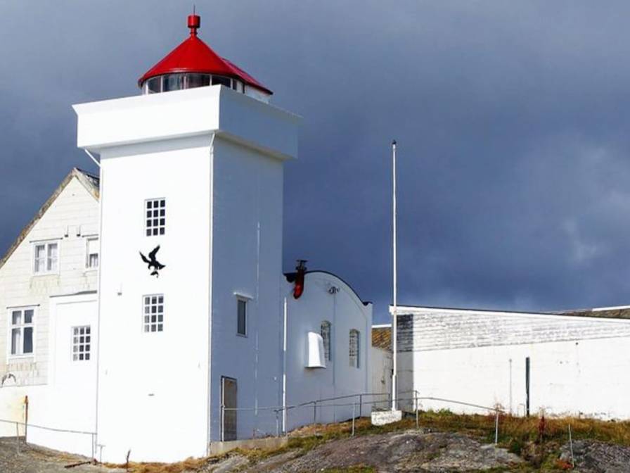
The stretch we’re sailing through now is known as the Trondheimsleia, one of Norway’s most important historical sea routes. It runs for about 170 kilometers and is naturally protected by islands, mountains, and skerries. This made it ideal for sailing ships, coastal cargo vessels called jekter, and Viking longships — and later for steamships and high-speed ferries. Today, it’s part of the main shipping lane along Norway’s coast, with tens of thousands of vessels passing through every year. Some parts of the Trondheimsleia are as deep as 500 meters, and navigating it requires deep knowledge of currents, winds, and narrow passages — especially in bad weather. Along the route, you’ll find several lighthouses and beacons to help ensure safe passage. One of them is the Terningen Lighthouse, which we’re passing now. First lit in 1833, it features a 12-meter tall concrete tower with a focal height of nearly 18 meters above sea level. That gives it a range of 13.4 nautical miles — or about 25 kilometers. As we sail on, we’re following in the wake of countless generations who have relied on this seaway, from Viking warriors to modern mariners.